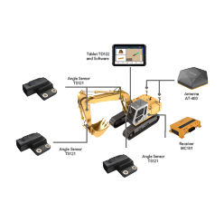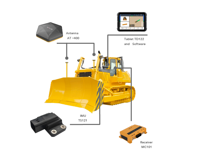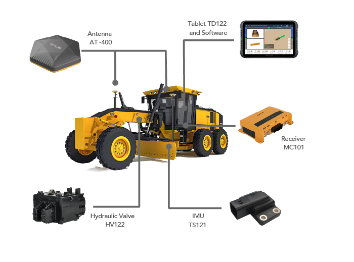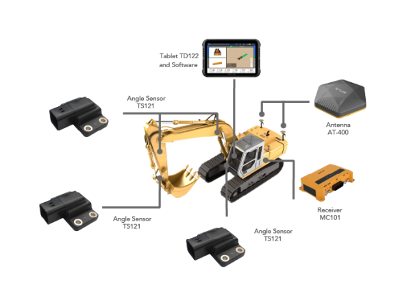
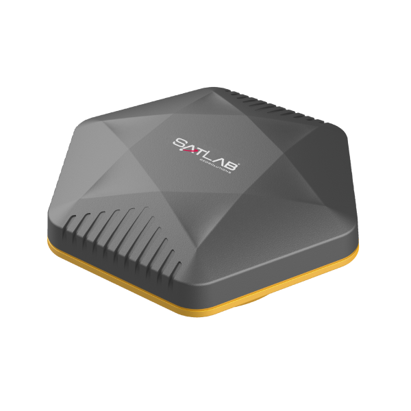

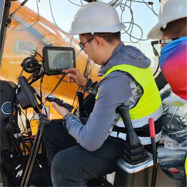


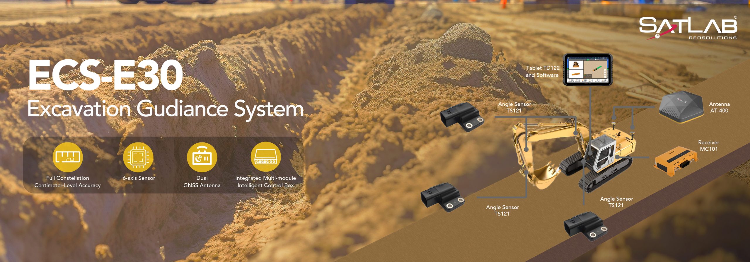
The ECS-E30 excavator guidance system provides real-time, precise positioning and heading information, significantly improving the accuracy and efficiency of excavating to target design coordinates. Its intuitive, user-friendly interface and advanced GNSS antenna positioning technology, combined with proprietary sensors, enable even novice operators to complete excavation tasks more quickly and productively than ever before.
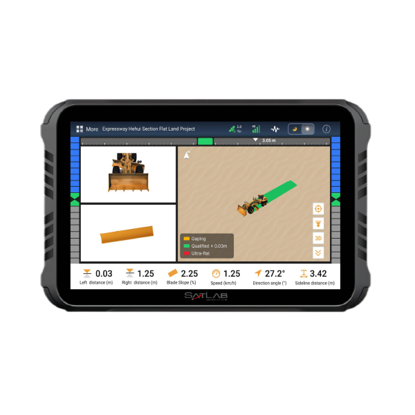
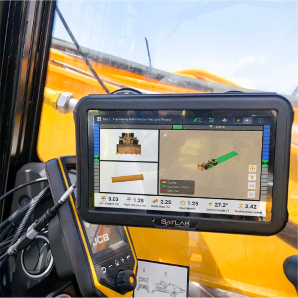
The ECS-E30 excavator guidance system provides intuitive 3D visualization on an in-cab tablet, offering operators comprehensive construction data such as design surfaces, cut/fill information, slopes, depths, reference lines, and excavation progress, enabling operators to visualize excavator movements in real-time.
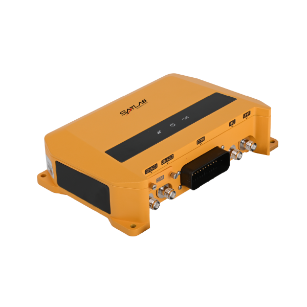
Powered by high-precision dual-GNSS and customized IMU sensors, the ECS-E30 excavator guidance system delivers accuracy within ±3 cm. The dynamic model algorithm ensures optimal bucket accuracy in all positions, and the high-performance receiver guarantees precise positioning across various terrain conditions.
The geo-fencing feature proactively alerts operators to potential hazards, preventing unauthorized access to restricted areas and significantly improving job site safety. By eliminating the need for additional surveying personnel, the ECS-E30 excavator guidance system further mitigates risks and enhances overall safety standards.
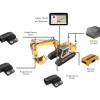
The ECS-E30 excavator guidance system’s adaptable design ensures compatibility with a wide range of equipment, including excavators, graders, and dozers. Operators can easily switch machine receivers, antenna and tablet between these types of equipment, allowing for efficient and versatile operations across their entire fleet.