Apus-MX UAV LiDAR

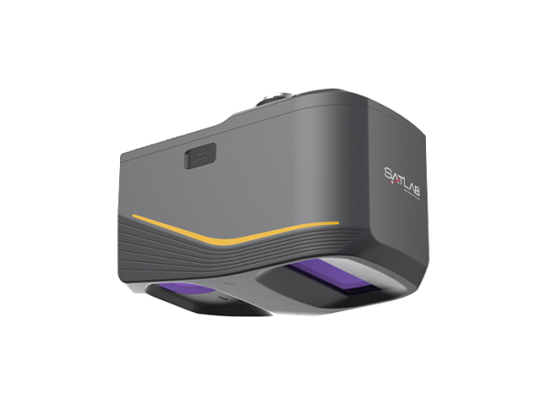
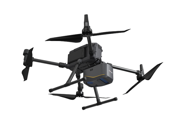
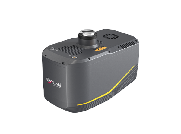
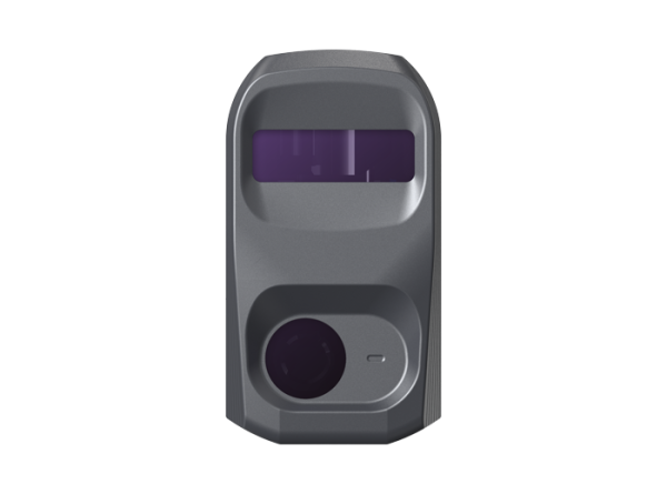
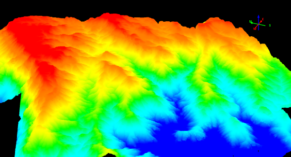
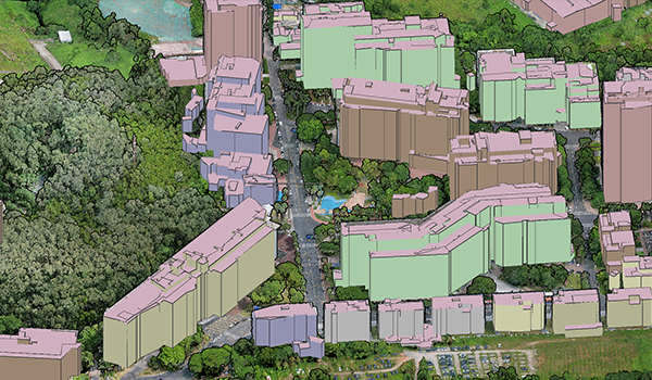
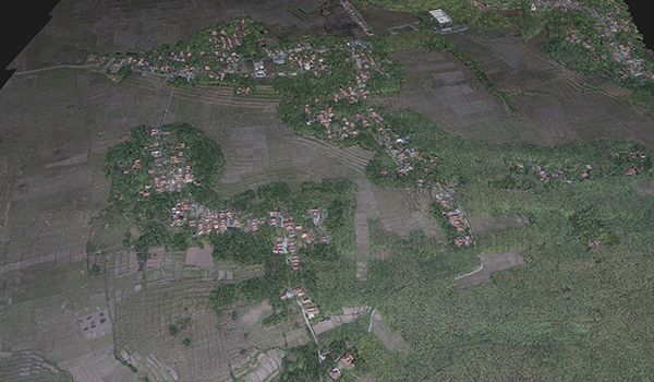
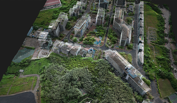
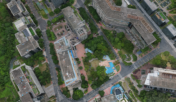
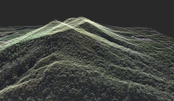
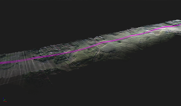
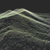
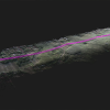
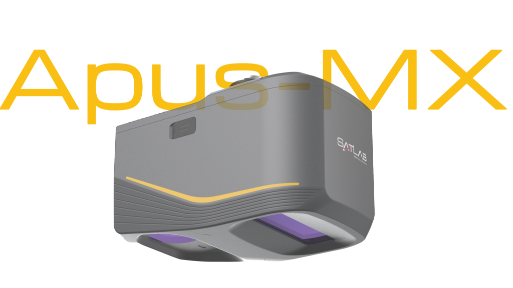
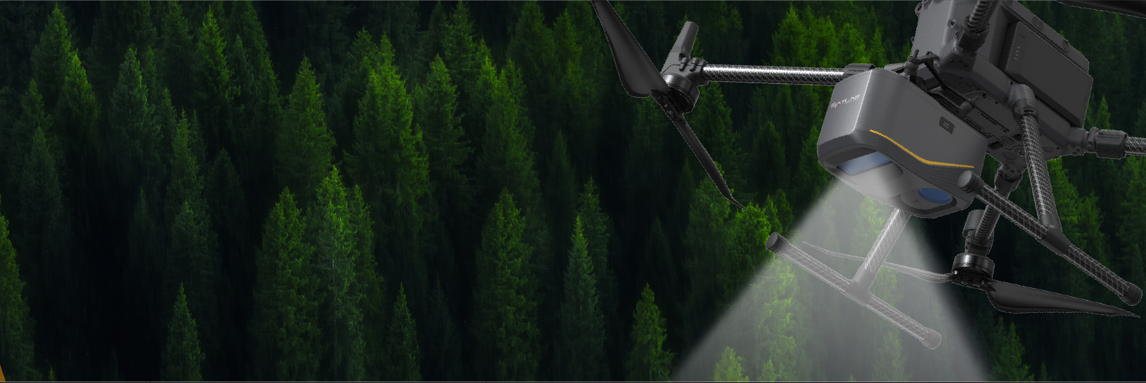
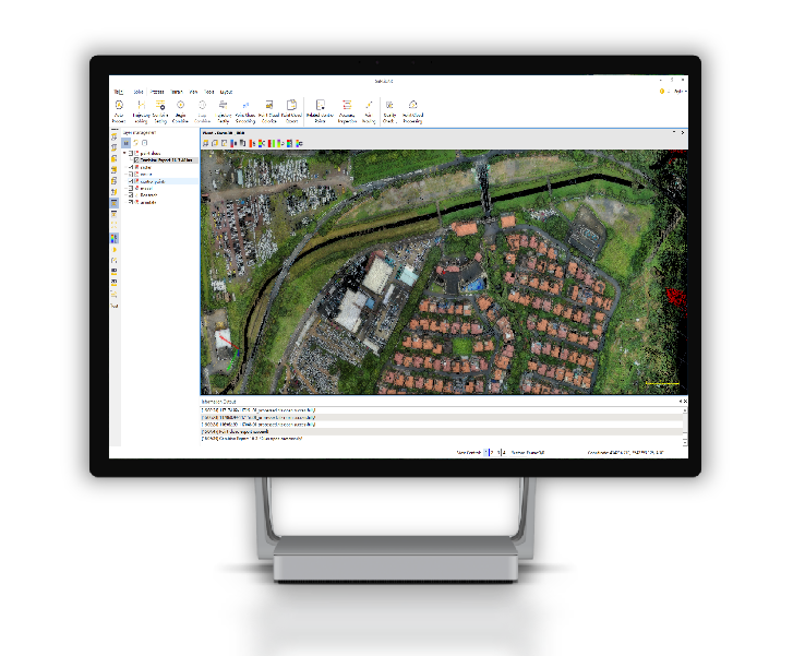
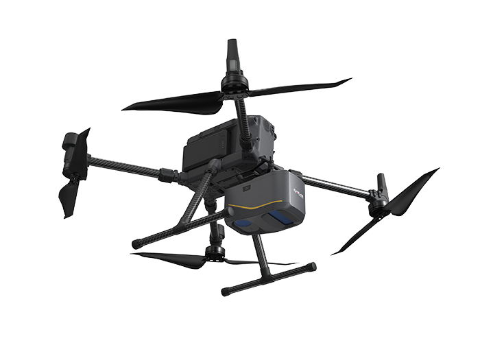
As the newest advancement in the Apus series, the Apus-MX UAV LiDAR represents a groundbreaking leap in aerial surveying precision and efficiency. Designed to tackle both complex terrains and urban environments with substantial structural variations, the Apus-MX maximizes productivity while significantly reducing operational time. This ultra-portable system seamlessly integrates a powerful long-range laser scanner, an advanced IMU, and an industrial-grade RGB orthographic camera, delivering unparalleled accuracy and setting a new industry standard.

UAV LiDAR System

Revolutionize Your Surveying with Unmatched Precision and Efficiency

Whether you’re navigating complex terrains or surveying urban environments with significant variations in structural heights, the Apus-MX UAV LiDAR is designed to deliver unparalleled efficiency and accuracy. Optimize your workflows, increase productivity, and save valuable time with our cutting-edge technology.

1200 m laser scanning range 
1.55 kg lightweight
Up to 8 returns
80° field of view
550,000 points per second
260 scans per second

Powerful Long-Range Laser Scanner
With an 80° field of view and a maximum range of 1200 meters, the Apus-MX can fly at higher altitudes to cover larger areas in fewer flights. This means you can reduce your operational costs and flight times, all while improving safety and reliability with better obstacle detection in tricky or hazardous areas.
1.55 kg Ultra-Portable Design
Easily transported and rapidly deployed, making it perfect for dynamic field operations and seamless integration with DJI gear for dynamic field operations.
Airborne LiDAR System
Dense Vegetation Penetration

The Apus-MX can penetrate through thick foliage with up to 8 returns, capturing ground point clouds efficiently. These point clouds are perfect for creating super accurate digital elevation models (DEM) and digital surface models (DSM), making it ideal for forestry and other applications.

Industrial-Grade RGB Orthographic Camera
With a 45 MP RGB camera, the Apus-MX delivers high-resolution images and top-quality color point clouds, making 3D model reconstruction and digital ortho mosaics a breeze.

Advanced Inertial Measurement Unit (IMU)
This technology ensures enhanced stability by guaranteeing reliable data integrity even over uneven surfaces, while also providing superior positional accuracy that is essential for conducting high-stakes surveying tasks with precision and confidence.

Post-Processing Software

Airborne Laser Scanning

Sat-LiDAR

One-click Wizard 
One-click to generate color point cloud automatically.
Strip Adjustment & Smoothing
Intelligent strip section, adjustment and data optimization.
Point Cloud Colorization
Export color point cloud from single photos and ortho-photos.

Sample Data

Apus-MX for Road and Power Patrol
Apus-MX for forest surveying
Construction and Engineering
Apus-MX for Construction and Engineering

Applications

  • Surveying and Mapping
  • Road and Power Patrol
  • Mining and Quarrying
  • Historic Preservation
  • Emergency and Disaster
  • Construction and Engineering
Apus-MX-2