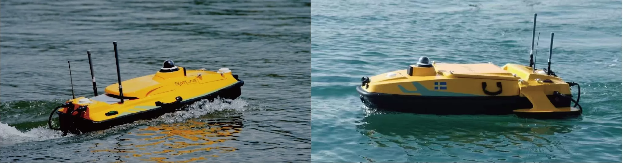
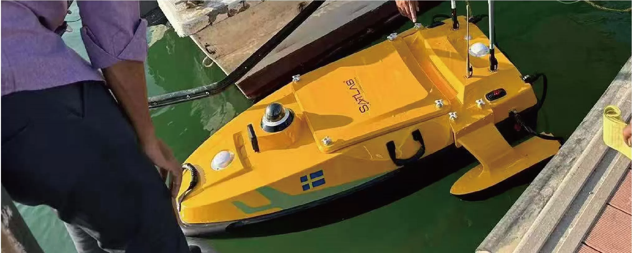
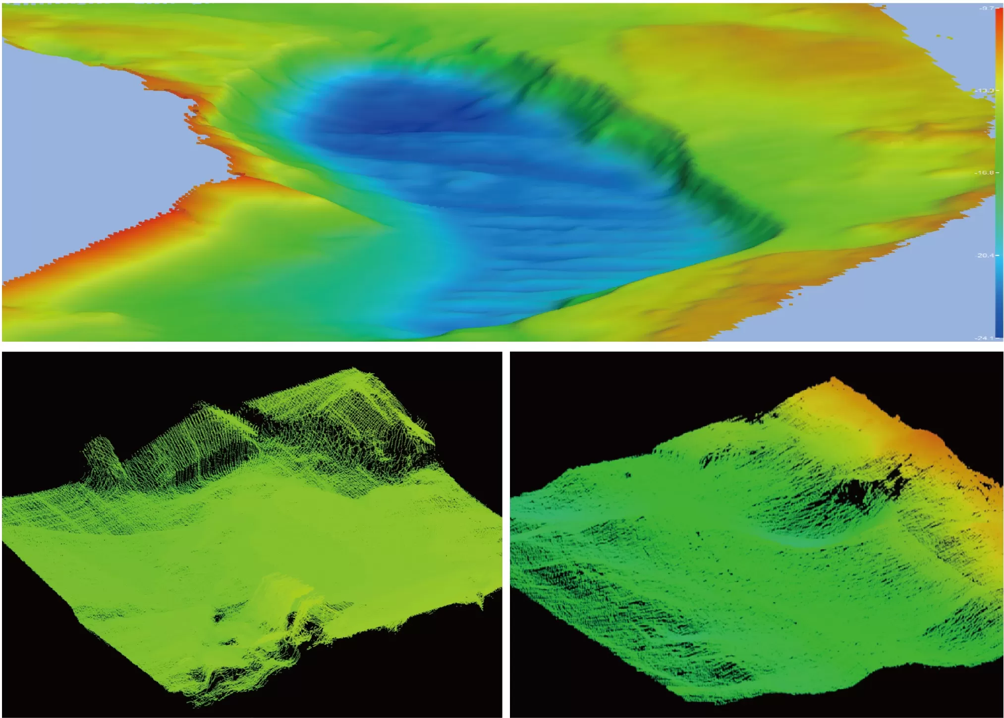
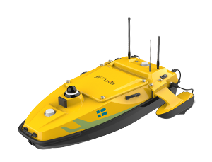
HydroBoat 1200 USV
HydroBoat 1200—an embodiment of compactness and ease, tailored for seamless operation across a spectrum of equipment.
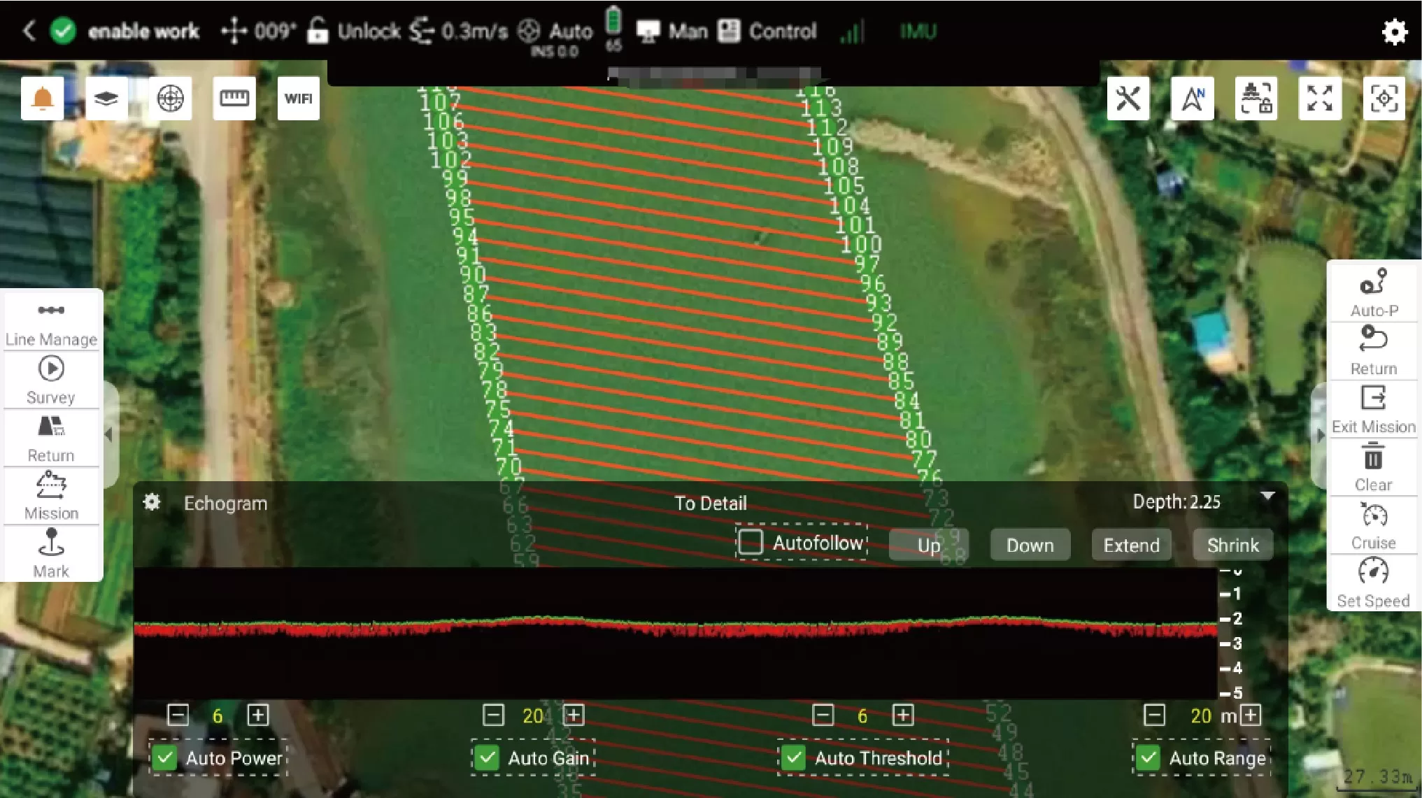
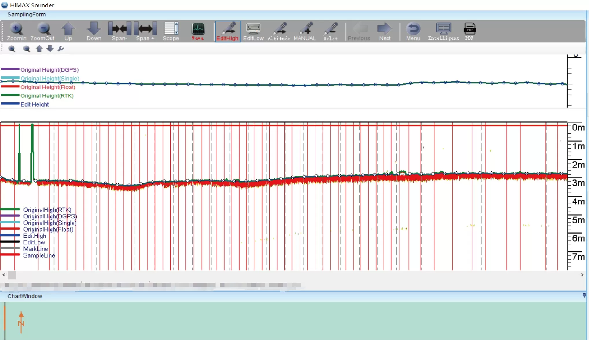
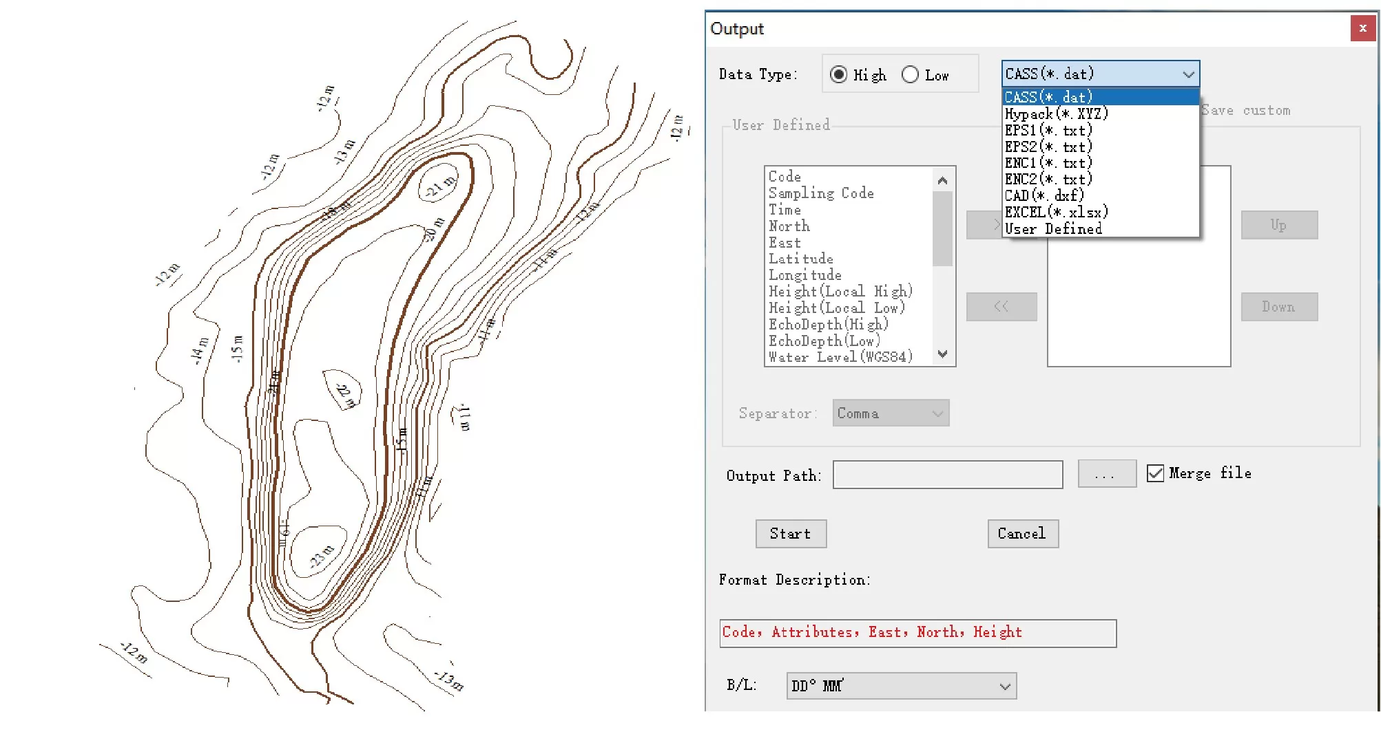
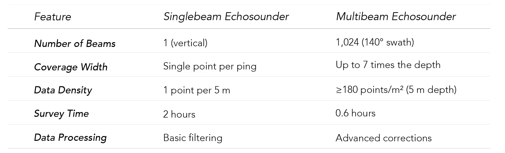
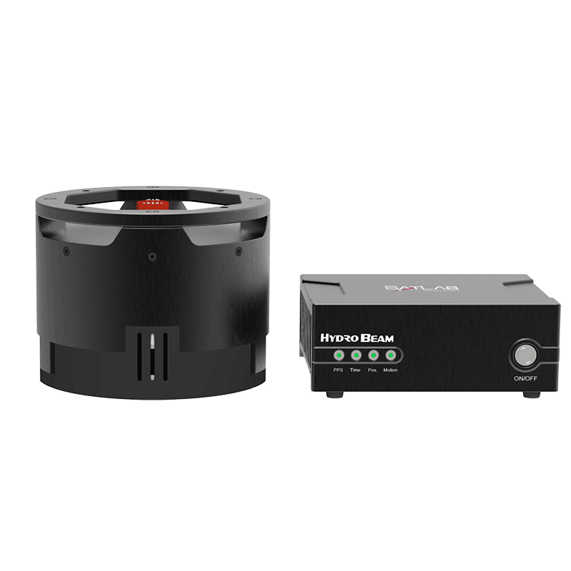
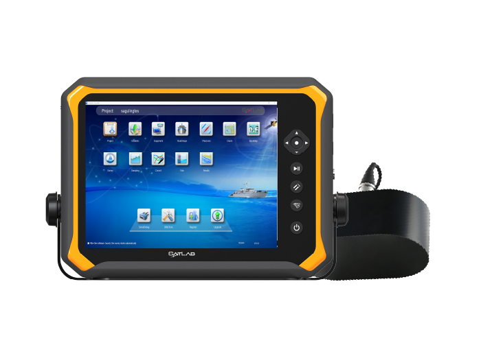
Enhanced by professional CFD technology, its stability finds new heights. Melded with high-precision single-beam echo sounder, GNSS directional positioning receiver, and an advanced intelligent boat-control system, it deftly serves varied water operational demands.
Augmented safety through embedded IMU, 360° pan-tilt camera, and millimeter-wave radar fortifies its attributes comprehensively. This autonomous vessel, which can be mounted with leading ADCP, side-scan sonar, dual-frequency sounder, multi-parameter water quality meter, image sonar, and more, stands poised as the quintessential partner for tasks encompassing current measurement, bathymetry, underwater survey, and water quality assessment.